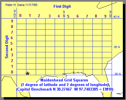
The Maidenhead Grid Square system was designed to facilitate the designation of geographical positions for use within the amateur radio community. The Maidenhead Grid identifies “Fields” consisting of an area twenty degrees of longitude by ten degrees of latitude with two alphabetic characters. An additional set of two numeric digits locates a specific two-degrees of longitude by one-degree of latitude” grid square” area within the Field. Two additional alphabetic characters can be used to refer to a 5.0 minutes of longitude by 2.5 minutes of latitude “Sub-Square” within the Grid Square. In each case the longitude character precedes the latitude designator.
Variations and extensions to the Maidenhead system are in use. Some Global Positioning System (GPS) receivers display positions in an extended Maidenhead system that appends one or two additional sets of numeric and alphabetic pairs, increasing the precision with which a location can be specified.
Some amateur radio operators use other terms for the Maidenhead system such as World Wide Locator (WWL) squares or QTH locator squares.
Ham operators use these grid designators to communicate transmitter positions to each other. Several utility programs are available to convert between latitude and longitude and the Maidenhead Grid Square system. Some of these also allow computation of distance and azimuth between stations.