It was first slated to happen during late summer of 2004, but Robert switched jobs earlier in the year and vacation was non-existent. Not a problem, we would reschedule for the following summer. Four of us had ran the Rubicon several years ago and we were going to run the Dusy-Ershim together. Bruce, Michael, Robert, and myself made it 18 miles through the Rubicon and we knew we could do 33 miles over the Dusy. It was just a matter of getting everyone together during the same week to make it happen.
By the time spring 2005 rolled around, we had started an e-mail thread between the four of us to make plans and discuss equipment, vehicle needs, etc. It wasn’t too long before the first bad news came from Bruce. The company he works for threw a monkey wrench in the gears and there was no way Bruce could make the trip. It wasn’t too soon after that before Michael informed the group that he may or may not be able to make the trip. Some issues at work came up and while he believed it would not interfere with the trip, he was not certain. As it turned out, about 4 weeks before the trip was to happen, Michael informed us that he would not be able to participate.
Another snag came along which caught all of us by surprise, namely “Mother Nature” and her plethora of snow from the previous winter. Robert received a couple of pics via e-mail, around the 4th of July, that showed about 6 feet of snow on the trail. A contact at the forest service stated that there was a 25% chance of the trail NOT opening for the 2005 wheelin’ season. Prior to the trail being “officially opened” for the season, the trail has to be cleared of the winter deadfalls. It is my understanding that some of the local Fresno, CA 4×4 clubs work with the forestry folks to make this happen. As it was, on or about August 1st, the announcement was made that the trail was open. Robert and I agreed to run the trail and who ever else could make it would do so.
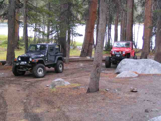
Near the end of August, when we new for certain that there was just the two of us making the run, Robert contacted another Jeeper in California that had run the trail before and asked if he would be interested. Lee agreed to join us and so that officially made three vehicles in the run. As it turned out, Lee’s father, Ed, joined him on the run so there was four of us hitting the trail together.
Our run date was late in season, at least as far as trips into the Sierra-Nevada mountains go. The trail head starts at an elevation of about 8100 feet and climbs to over 10,100 feet before the trail ends. While it would be shirt sleeve weather in Phoenix or southern California, it would be much cooler at that altitude on the trail. I packed a variety of clothes, not knowing just what to expect but needing to be ready for just about anything we might encounter.
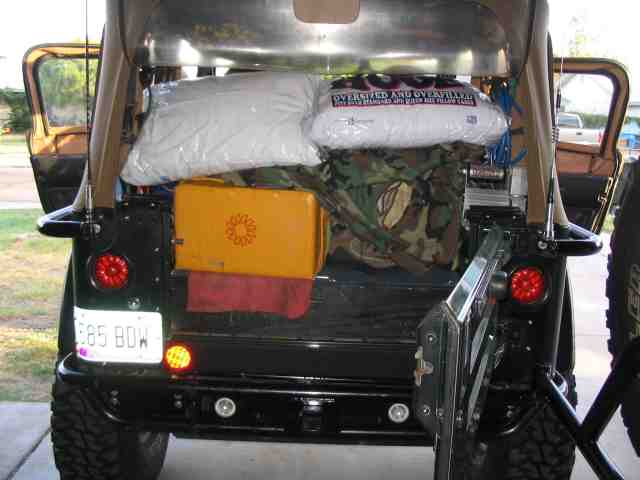
September 23rd found me packed up and ready to head for California. I had plenty of food and camping gear loaded into the TJ. As I was sorting through the pictures I had taken during the trip, I had to chuckle a bit when I noticed the label on the pillow in the above picture…..it says “Oversized and Overfilled”. That pretty much summed it up as to the condition of the TJ and the upcoming trip.
I spent part of Friday driving to California and then hooked up with Robert. I stayed the night at his house and we headed out to Fresno the next morning. He had booked a room at a motel in Fresno and after leaving his tow rig and trailer at Lee’s in-laws place in Kingsburg, we pulled into Fresno to spend the night.
While waiting for a Lee’s phone call on Sunday AM, Robert and I made last minute adjustments to our rigs (hey, we needed something to do!). A few extra ratchet straps were pressed into service, another bag of ice to go along with the dry ice we had picked up the previous day, etc. About mid morning, we heard from Lee. Arrangements were made to meet him and Ed about 3/4 of the way up the mountain where Lee would then park his tow rig and trailer. Robert and I hopped into our Jeeps and headed for Shaver Lake, the last place we would top off our gas tanks before hooking up with Lee and getting to the trail head.
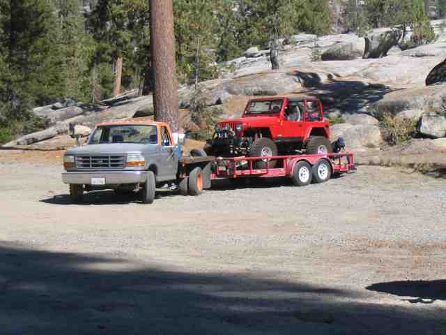
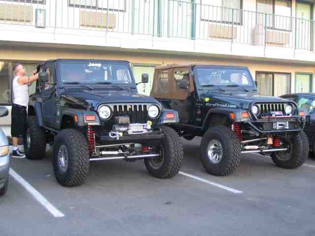
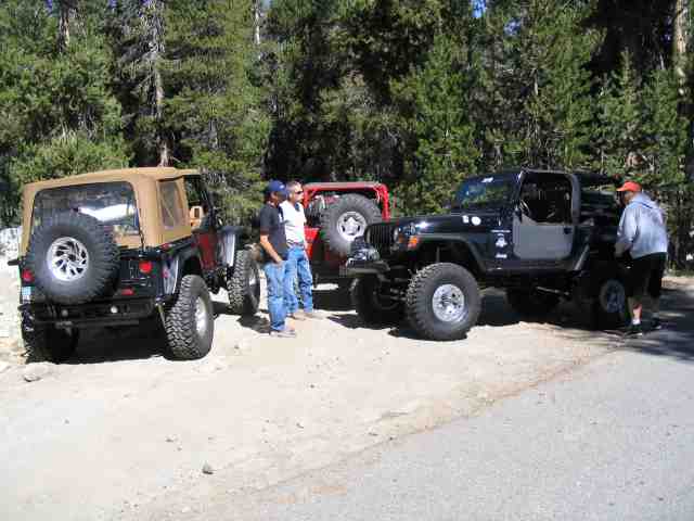
About 10 minutes out of Shaver Lake, Lee parked his tow rig and trailer and got the TJ onto the ground. Everyone had done there maintenance BEFORE the trip started and so the only problems we were expecting were driveline or suspension related. Robert and I had discussed spare parts during the previous months and had the important items covered. The fact that we were running similarly equipped rigs made it much easier to ration valuable TJ space for spare parts. We both have a complete Warn hub conversion (including chromoly inners) up front and Alloy USA D44 rear shafts. We both run the Toys by Troy Alumi-flex suspension and steering so items like spare rod ends and cartridge joints could be shared between vehicles, if needed. Lee was sporting D60 RockCrusher full width axles on his TJ. We all were running t-cases in the 4:1 range, either Tera or Atlas II, and ARB air lockers solved the traction issue for all the vehicles. Robert and I were on 35″ MT/Rs and Lee was pushing 36″ Iroks on his TJ. We weren’t going to be any more ready than we were. Robert had his Ready Welder II along, just in case some trail welding was required. Simply put, we were about as ready as anyone could be. It was time to hit the trail!
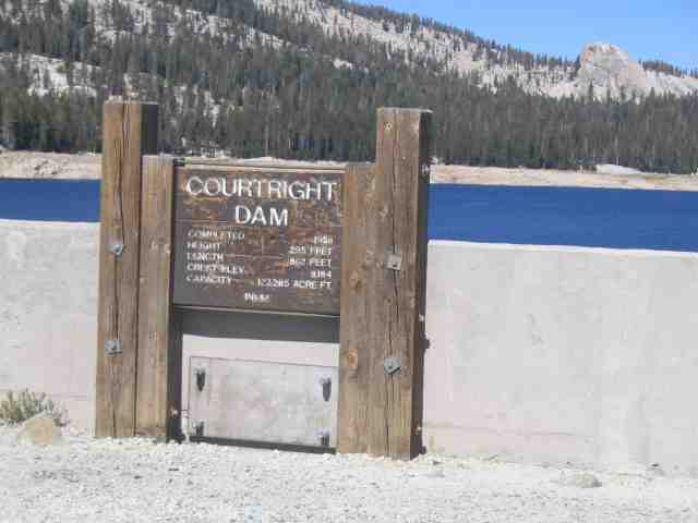
The first stop after turning off the twisty-turn road up the mountain was Courtright Reservoir. To get to the trail head, you drive across the top of the dam. Being from Arizona, I was completely taken back by the bright blue water. The lakes in Arizona (all 5 or 6 of them), are quite muddy, so seeing this water was quite a treat. I could have sat on the dam wall and watched the world go by for quite a while….it was just plain beautiful.
The dam is 295 feet tall and over 800 feet long. If you do an about face from looking that the sign (in the previous picture), you can take about 4 giant steps and step off into the canyon that has just a trickle of water still in it. You have quite an impressive view from atop the dam.
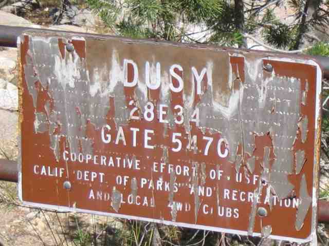
Dusy-Ershim Trail
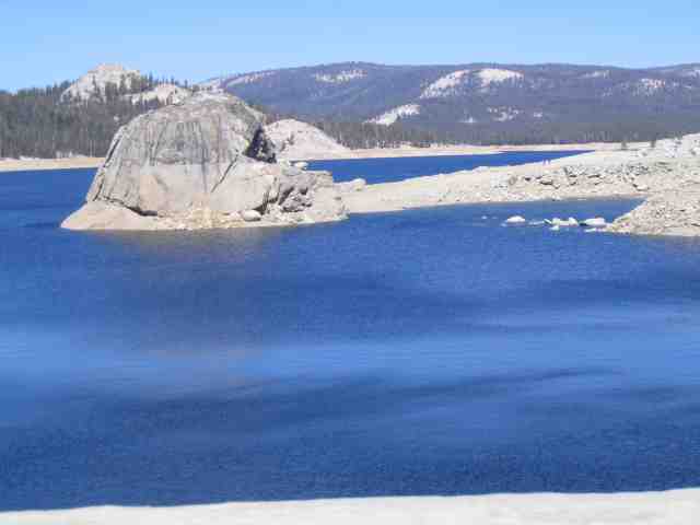
OK….I can’t help myself….here is another picture of the Courtright Reservoir. You can see the high water mark on the rock in the middle of the photo. The water level was down some. No doubt the winter run off fills it up early in the year.
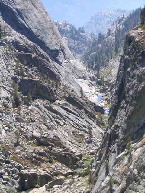
Once across the dam, it is a very short distance to the trail head. The Dusy-Ershim trail is actually two trails that join at Black Peak. When running it North to South, you start on the Dusy and end on the Ershim, coming out near Kaiser Pass. The trail is rather unique in that it winds its way between two wilderness areas, those being the Dinky Creek and John Muir wilderness areas. The trail exists within a 600 foot wide corridor where vehicle travel is permitted.
Just a few minutes from starting the trail, we all aired our tires down for max traction and a softer ride. As I write this, I have to chuckle a bit….Lee had loaned his deflators to someone earlier in the season and did not realize that they were now set a higher pressure. This resulted in his tires only going down to about 11 PSI rather than the 8 PSI that he normally runs on the trail. I didn’t know this and during the 1st day, it didn’t make sense why Lee was struggling to get over some of the obstacles that Robert and I (with smaller tires) managed without any issue. Later on, Lee realized what had happened and the problem was quickly rectified. I can tell you that those Iroks at 11 PSI don’t hook up on rocks worth anything.
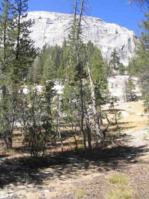
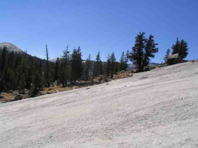
You are not on the trail for very long before you start seeing some of the magnificent granite domes that populate the trail. I’ve not been to Yosemite but Robert informed me that if I liked the views here, I would really appreciate what Yosemite had to offer.
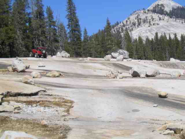
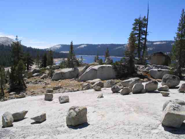
This is one of several large granite slab that the trail traverses. Unlike Moab, you won’t see tire tracks going across the bare rock. One of the Fresno 4×4 clubs has helped align the rocks to kind of guide you along the path, so to speak, so that you end up coming out at the right spot and can continue the trail as it enters the treeline.
Dusy-Ershim Trail
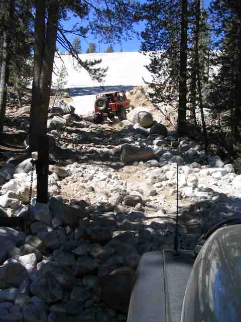
If memory serves me correctly, this is the bottom of another huge granite slab known as Chicken Rock. Lee works his way around a couple of large rocks just before he gets onto the slap and starts a rather steep ascent. The traction is nothing short of awesome so not to worry….you will make it to the top.
The view out of the driver’s side window as you climb the granite slab. It is actually just a bit steeper than this. As you can see, I had the camera tilted a bit and it took at little bit away from what was actually there.
At the top of Chicken Rock, you can see the Courtright Reservoir. This is, in my opinion, one of those million dollar views that simply don’t quit. Can you imagine having a view ;ole this off of the front deck of your house?
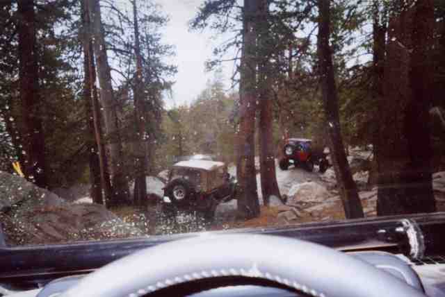
This is part way up Thompson Hill, the last section of trail we did before calling it quits for day #1. Thompson Hill is only .2 miles long but you will gain some 600 feet in elevation once you get to the top. It was not overly difficult, but you had to stay focused, picking your lines carefully. Getting yourself sideways on parts of this section would quickly put you over onto your side.
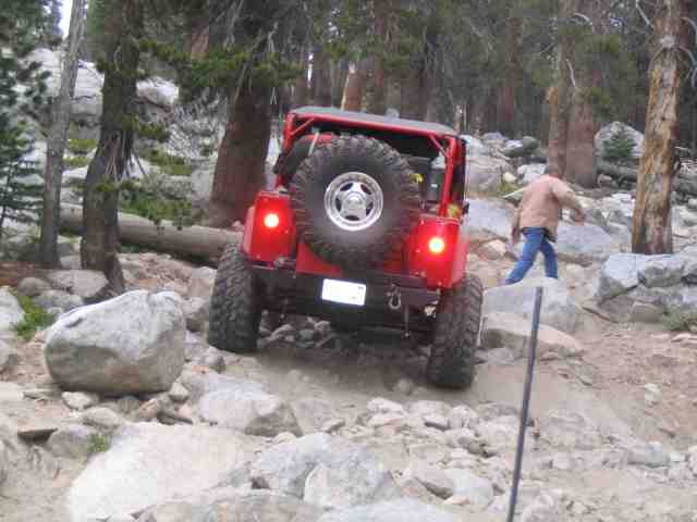
Robert caught me working my way through more of the rocks that made up most of Thompson Hill. If I had to compare it to another section of trail that we had ran, it was probably along the same lines as Cadillac Hill on the Rubicon Trail. We all managed to get hung up on one ledge but a couple of rocks solved the problem. For the most part, leaving the rear ARB engaged and the front ARB open provided reliable traction while allowing the necessary steering for good tire placement on the rocks. We topped Thompson Hill shortly before sunset.
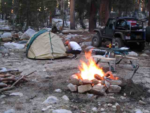
Shortly after finishing Thompson Hill, we found a turn off from the trail that had a fire ring needing just a bit of repair and plenty of room to set up a couple of tents. This would be home for the first night. We quickly broke out our camping gear, erected tents, unfolded the chairs, and got a nice warm fire going. The fire was not quite as big as it appears in the above pic…..I was shooting a time elapsed picture when it was taken so the flames looked better than they actually were.
Robert broke out a little gas grill he had brought along and soon had his Tri-Tip sizzling. Donna had packed a number of dinners for me that were frozen before going into the cooler. With the dry-ice I had put in on Friday evening, everything was still quite frozen. I fired up my single burner butane backpacking stove and had my dinner warmed up in about five minutes. We had skipped lunch (hey, that is why you stash jerky in the center console) so everyone was pretty hungry and dinner tasted great. The sunset caused a most wonderful illumination of the nearby granite rocks, turning it a brilliant red/yellow. Unfortunately, catching that with a camera and no tripod turned out to be a very blurry picture. You’ll have to trust me that it was a site to behold.
We spent a couple of hours talking around the campfire, talking about the usual things….other Jeep trips, suspension systems, etc. Somewhere around 9:30, we called it a day and turned in for the night. Several hours after that, the first bit of rain started.
Dusy-Ershim Trail
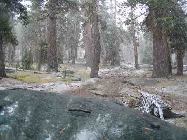
Somewhere in the middle of the night, a storm front moved in. We awoke to a light rain which was quickly followed by hail, sleet, and snow at various times. We were lucky in that it was not coming down hard…..we were unlucky in that we were at 9600+ feet and still had to climb to more than 10,100 feet by the end of the trail. The picture above was taken about 30 minutes after we broke camp and hit the trail. Ground temperature had not yet hit freezing although compared to the previous day’s weather, it was working pretty hard on getting there. It wasn’t long before the temps were in the 40 degree range.
The precipitation, in what ever form it happened to be arriving in, was on again, off again, most of the morning. We were about 22 miles from the end of the trail when we started day #2. A quick discussion on the radio was had and it was decided to push through to trail’s end, hopefully making it out by nightfall. Luckily, the trail never really turned into a mud pit…..and that we were grateful for. Both Robert and I were quite pleased with the performance of our MT/Rs. While it was nothing like crawling on dry rocks, they did much better in the wet climate than I was expecting.
Just as we were nearing Ershim lake, about 3:00 in the afternoon, the weather let up for a couple of minutes and we hopped out to stretch our lakes a take a couple of pics. The picture above is the Ershim Lake camping area and had been the spot where we were to spend our 2nd night on the trail. Robert and Lee had both brought their fishing gear in hopes of finding a few trout. Needless to say, it was never unpacked.
Robert took this picture through the windshield. Lee is just entering the off-camber part of an obstacle known as Divorce Rock. It is a large slab of granite that you kind of straddle and at the last moment, make a hard right turn into the off-camber down hill side for the exit. I imagine that one’s spouse, riding in the passenger seat, would get pretty freaked out while waiting for the roll over to happen. No one rolled but with the rock wet and mud on the tires, the pucker factor was certainly a notch or two higher than normal, especially with no one spotting.
Up to this point, we had been averaging a bit over 2 MPH on the trail, which is faster than what we had originally planned on. Plenty of rocks and oh so many tight squeezes between the trees made for almost no out of vehicle sight seeing as we were trying to power drive the last 11 miles before the dark settled in at 7:00 PM.
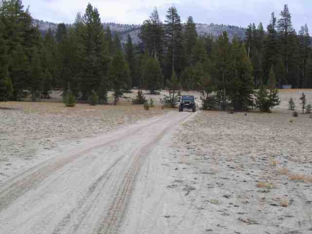
We got one more break in the weather, enough to snap another picture of Robert coming up behind me on this little sandy stretch of trail that cut through a high meadow at nearly 10,000 feet. Given the weather and our progress, we could have used a lot more of this and a lot less of the twisty-turny trail we were seeing.
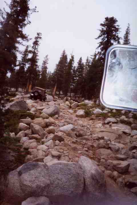
As the sun was setting, we hit the last section of trail that was guaranteed to be the most difficult of the trip. And sure enough, it was. I can best describe it as a area that looked to have been cratered by mortar rounds or maybe large land mines. It would have been a challenge in the daylight but picking one’s way through it in the dark with wet everywhere made it twice as bad. Lee did a great job of leading us through this section of the trail….it was anything but marked, with tire tracks going a multitude of directions to get over the rocks and ledges. Fortunately, it was on a down hill grade which put gravity on our side.
We hit asphalt about 7:30ish in the evening on day #2. What we had planned on being a 3 or 4 day trip was compressed into one normal day and a hellish day of power driving to finish ahead of the weather…..and finish just ahead of the weather is what we did. With rain coming down a lot heavier than desired, we aired up our tires and headed down the mountain. We were not five minutes down the road when the clouds tore open and dumped a wall of rain so thick that I completely lost site of Robert’s tail light’s that were no more than 30 yards in front of me. We dodged the bullet on that one big time!
The plan was to hold up in a cabin, near Shaver Lake, that Ed had access to. Once there, we found that some other folks were using it for the week and so our plans changed again. Robert and I opted to drive the hour down the mountain and grab a motel room in Fresno. Lee and Ed decided to head back home but that changed once they got to the tow rig and trailer. They spent a wet and cold night there and then headed back up to Courtright Reservoir the next morning to run another trail. I guess they were not very surprised when they found 8″ of fresh snow at the dam…..the same spot that just 48 hours previous had us all in shirt sleeves while airing down our rigs.
To say that the Sierra-Nevada Mountains can change your plans in a heart beat could be putting it mildly….and if you plan on making the trip, you need to be prepared for such a thing. The weather forecast, which we had checked the morning of day #1, while still in Fresno, had no mention of the pending weather front. And even if it did, I doubt we would have changed our plans. I had enough food for a week, without rationing, and sufficient drinking water for more than that. We had a total of 15 gallons of extra gasoline that we never used during the trip. In fact, I just touched the 1/4 mark on the gas gauge about the time we got back to Fresno, late on day #2. Robert’s automatic used a bit more than my manual tranny but only by a couple of gallons. We could have gassed up at Shaver Lake had we needed to do so after exiting the trail. We all had rain gear, warm clothes, heavy duty sleeping bags, etc. I know there was enough Coleman fuel and propane to heat/cook a week’s worth of meals.
Several friends asked if I was disappointed with the results of the trip. Absolutely NOT! Spending time with Robert, regardless of conditions, is something I look forward to every time we get a chance to wheel together. I do regret only having one evening around the camp fire with Lee and Ed. I look forward to getting another chance to share a trail with them. Who knows, maybe it will be the Dusy-Ershim again…..or another just as fun.
If you get a chance to tackle the Dusy-Ershim, do it! The scenery is beautiful and the trail is great. Many thanks to the Fresno 4×4 folks who help maintain the trail. You’ve done a great job and your efforts did not go unnoticed. A big thanks to Lee and Ed for leading the trail and helping with all those pre-trip details. And last but by no means least, a big thanks to Robert for putting up with me for the week. It means a lot to me to have a place to hang your hat while you are away from home.
Good trails and remember to TREADLightly!
Update: I rounded up the gasoline receipts. All in all, not too bad. I drove about 1580 miles and used about 107 gallons of gas…..that gave me about 14.7 MPG. Not bad when you consider that includes freeway, city, and trail mileage….and the Jeep was heavily loaded during 90% of those miles. The altitude ranged from below sea level (near Palm Springs, CA) to just short of 10,200 feet in the Sierra-Nevada Mountains. For a TJ on 35″ tires and 8″ of lift, I can live with those numbers.