I got an e-mail from BradW earlier in the week, wanting to know if I still wanted to go to Columbia. Yeah….I had the day open and so we made plans to meet at the air down spot at 8:00 AM. I’ve driven past Columbia a number of times, but the trail I was on was an hour from the old ghost town. I could see it from the ridge top but that was as close as I had ever gotten. The last time we were on that same trail together, I mentioned to Brad that I wanted to go down there some time. And so he found a connecting trail from the one we had run and gave me a call (this guy likes to explore new trails).
There wasn’t really much left at Columbia. The USGS quadrangle map shows more buildings than currently exist (which is now basically zero). A couple of foundations remain and that is about it. Not sure why the last two buildings were removed but they no longer exist. So, as with most ghost towns, they will live on in myth and memory and a few old writings, if lucky. A few details can be had at this ghost town site. And with that, I include a few pics that were taken along the way.
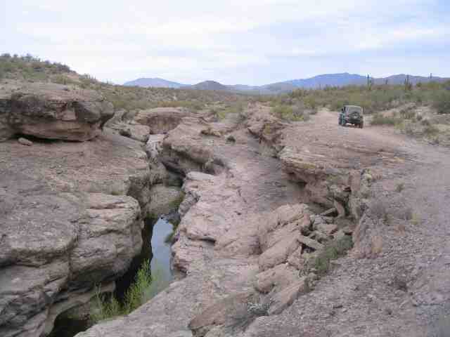
We headed down Castle Hot Springs Road and turned off to the east after we cleared the north end of Lake Pleasant. Humbug Creek flows out of the southern end of the Bradshaw Mountains into Lake Pleasant. Brad’s Rubicon is in the above picture (needed something for a size reference). Even though we are in a drought (130+ days without any rainfall), Humbug Creek still has a bit of water flowing in it. Springs and ground water cause a little bit of flow that keeps the riparian area going even when things get ever so dry.
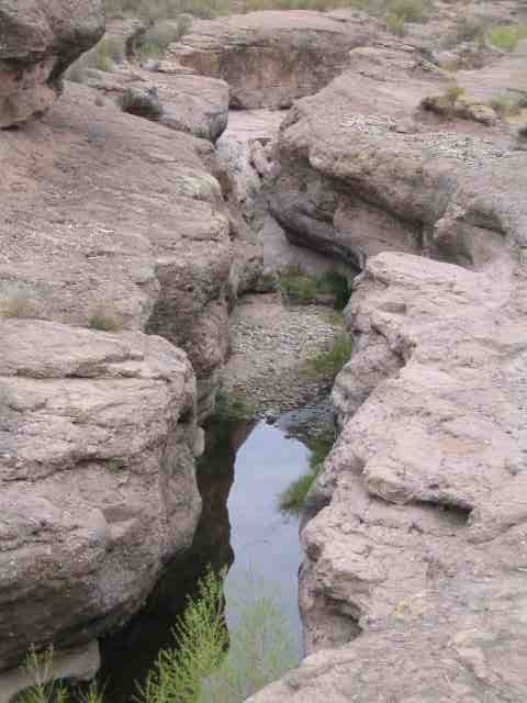
The creek, flowing for countless centuries, has carefully carved its signature into the bedrock. These slot canyons, if you want to call them that, are about 20 to 30 feet deep. We found evidence of flash flood debris that was well over the tops of these walls by 15 feet. The volume of water that could put the debris that high is impossible for me to imagine. I would love to see this area during a very wet season (right after a 24 hour thunderstorm).
There are two man made dams further up stream….looking to be well over 50 years old. Not huge constructions, but given their location, a difficult project to build. One is about 20 feet tall and spans one of the main flow areas in the creek. No water was standing behind them as both are in disrepair.
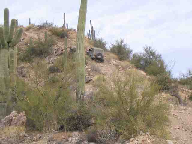
We pushed on out of Humbug Creek and started working our way up into the foothills of the southern Bradshaw Mountains. We had a couple of very fun climbs. I’ve always ran this section of the trail in the opposite direction and so these were always very steep down-hills. Today, they were very steep climbs to say the least. Brad is about 1/2 way up this one.
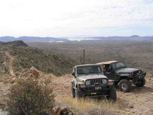
You can see a piece of the trail along the left side of the photo and Lake Pleasant is way off along the horizon. (where we took the Humbug Creek photos) Yes, this is a pretty long trail.
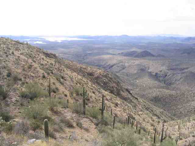
Taken from the same location as the previous photo….I moved a bit off to the side of the trail and found a rock to stand on. As we worked our way further along the trail, the cactus became quite thick on the hillsides.
Columbia Loop Trail
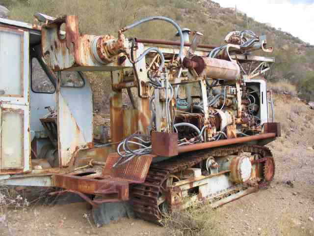
We finally made the turn off of the trail that both Brad and I had previously run and headed west towards Columbia. Brad stopped at one spot and we went up the hill a bit to see an old drilling rig. Obviously, this one is not left over from the mining days of 100 years ago.
Just got an e-mail from Brad. He sent along some photos of the second hill climb that he took from the top while I made the climb. As is usually the case, the photos do not do justice to this piece of the trail. Brad and I both agreed that open diff vehicles would not make this climb without some kind of assistance. We were both locked at each end and our tires would hunt and work through the loose overburden, trying to find a bit of traction.
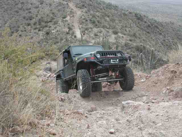
Yes….made it. I’d like to thank all those manufacturers that made the hill climb possible….ARB, Goodyear MT/R tires, AlloyUSA axle shafts, my newly installed AW4 auto tranny, Tom Wood drive shafts, Tera 4:1 t-case, and all those other drive line parts that come together to make a most excellent trip to the top of the hill.
We finally made it down the side of the mountain and into the wash below. This was where Columbia once stood. The house foundations were still there and some recent (plus or minus 10~20 years) mining activity was evident. Lots of these old claims get re-worked every now and again (or at least they initially did when gold when off the $32/ounce standard).
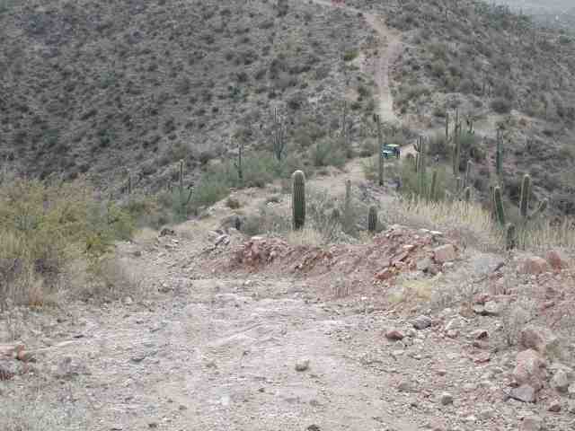
That is about it. We left Columbia and headed west towards the back road that leads to Crown King. Once on the old Crown King trail, we took a turn off to the west and spent about another two hours cruising in and out of the washes and seeing the sites. We ended up on Castle Creek road and then finally made our way back to Castle Hot Springs road where we headed back to the highway. When all was said and done, we had totaled almost 50 miles off the highway. The trip took us about 8 hours including the numerous stops for pics, lunch, etc.
I hope you enjoyed the trip….and remember to TREADLightly!